From I-90 Eastbound
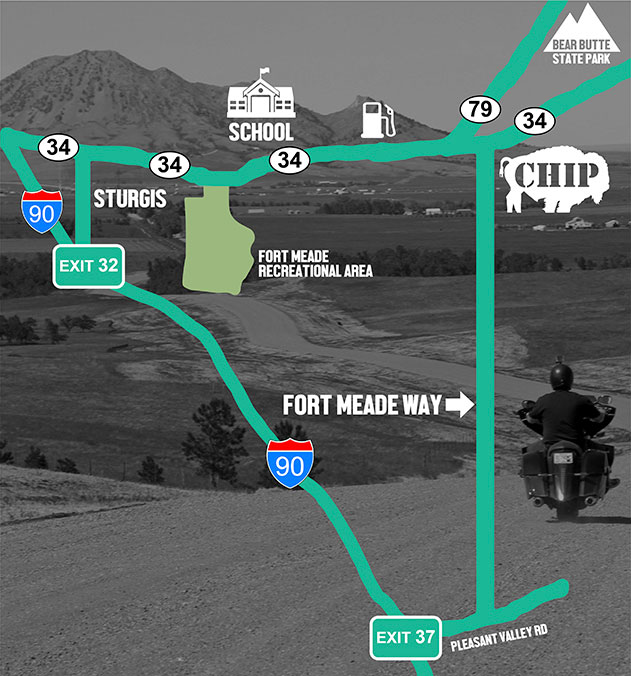
Take Exit 37 from I-90, travel East onto Pleasant Valley Rd. (0.8 miles)
Turn North onto Fort Meade Way. Travel to the Buffalo Chip. (4.8 miles)
If you are coming for the concerts and don’t intent to camp, turn east onto 207th (1 mile), then left onto 132nd Ave. to the concert parking lot.
Alternatively,
Take exit 10 and take a left (85 North) towards Belle Fourche.
Go through Belle Fourche until you get to the 212 Junction and take a right onto to 212 East.
At the end of 212 you’ll come to Hwy 79. Turn right onto 79 South and keep on that road till you pass Bear Butte on your left.
After Bear Butte you’ll come to another junction with a traffic light. Take a left onto Hwy 34 and look up to see our legendary Buffalo Chip sculpture welcoming you home.
Turn right onto Fort Mead Way and follow the direction of traffic attendants to join us for the Best Party Anywhere.
From I-90 Westbound
Take Exit 37 from I-90, travel East onto Pleasant Valley Rd. (0.8 miles)
Turn North onto Fort Meade Way. Travel to the Buffalo Chip. (4.8 miles)
If you are coming for the concerts and don’t intent to camp, turn east onto 207th (1 mile), then left onto 132nd Ave. to the concert parking lot.
Alternatively,
Turn off the interstate at Exit 61 and turn right onto Elk Vale Rd, heading North.
(Elk Vale Rd is not fully paved so those of you who are riding in might want to use the alternate route through Sturgis)
Follow Elk Vale Rd until it ends at Alkali Rd. Turn left onto Alkali.
Continue to the Buffalo Chip for approximately 15 miles.
Follow signage and directions of traffic attendants to get yourself into the campground as quickly as possible and join us for the Best Party Anywhere!
To Approach Via Sturgis,
Take Exit 32. Turn right at light. Travel approx 1 mile. Turn Right (East) onto Lazelle St. Travel 3 miles East to the Buffalo Chip.
OR
Take Exit 30. Travel East until you arrive at the Chip. (approx. 4 miles)
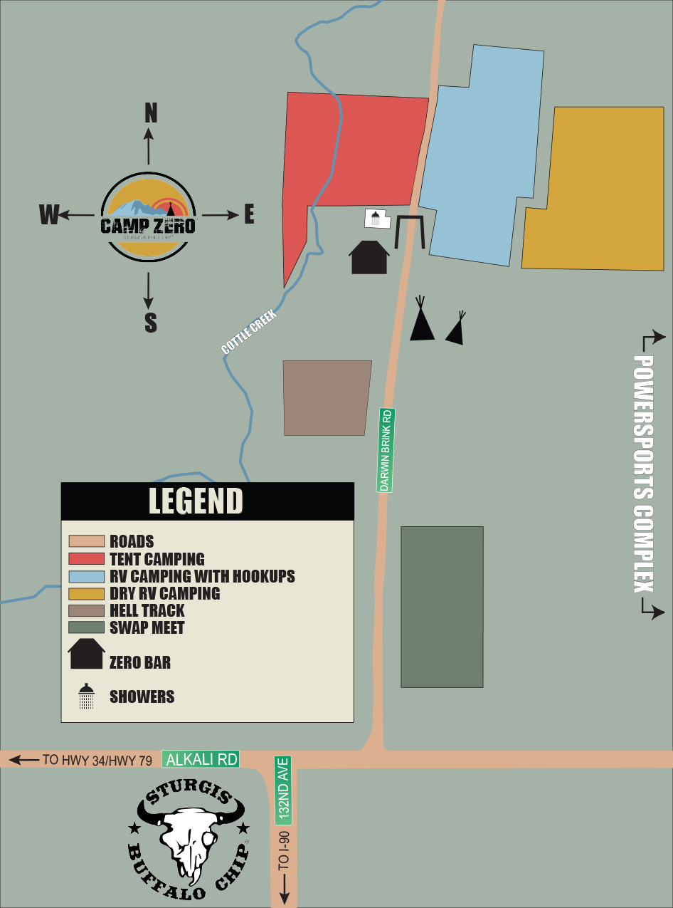
Arriving at the Chip
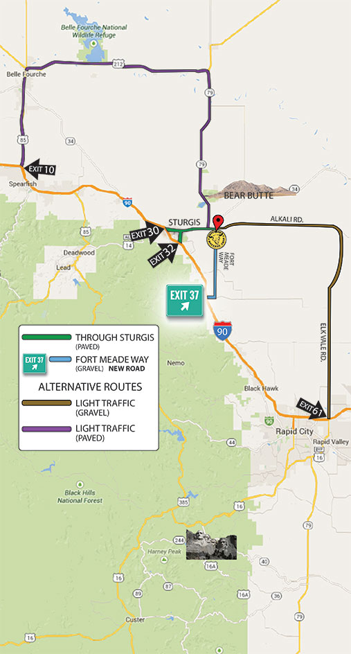
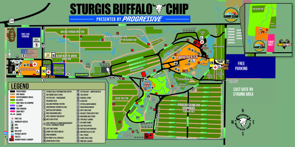
Crossroads Map
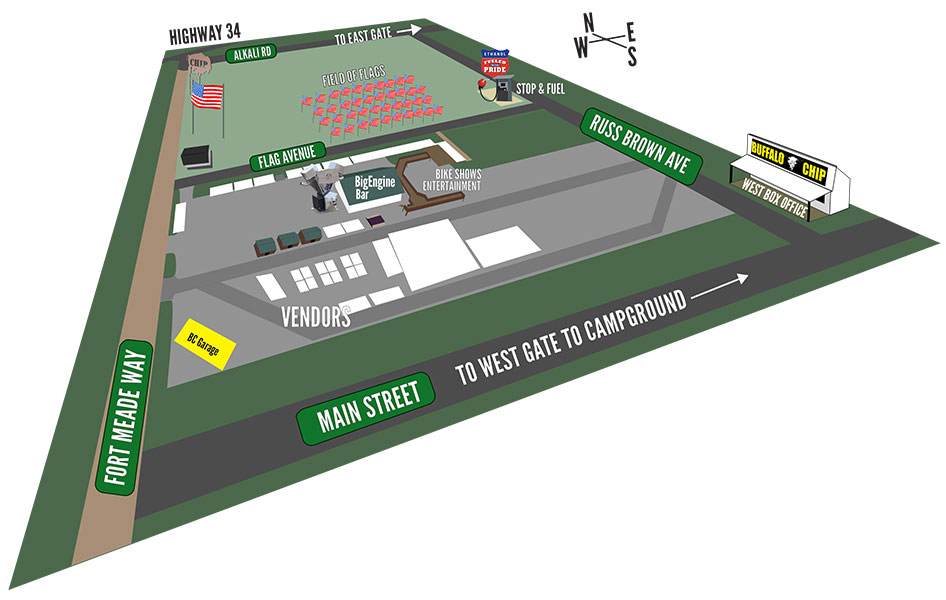
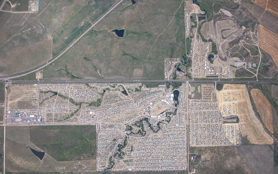
Aerial Photos
